
Sources de Jérusalem (Jerusalem Springs)
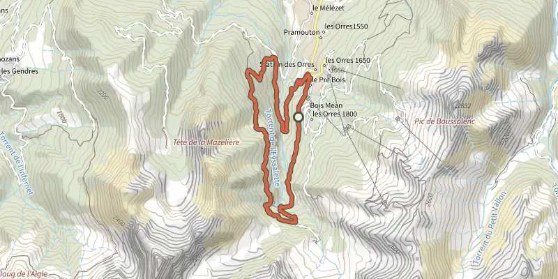
Key facts
- Distance
- 11.5 km
- Ascent
- +520 m
- Descent
- −470 m
- Estimated time
- 3 hr 35
- hiking
- Difficulty
- Moderate
- official rating
- Route
- Loop
- back to the start
Profile and gradient
- under 10%
- 10 to 20%
- over 20%
Gradient along the route: 7.5 km under 10%, 3.4 km at 10 to 20% and 0.6 km over 20%. Elevation from 1,513 m to 1,971 m over 11.5 km.
Surface and path types
- Surface
- Paved 12%
- Dirt & gravel 84%
- Unknown 4%
- Path types
- Trail 26%
- Track 58%
- Road 12%
- Off-network 4%
Description
The Sources de Jérusalem reward a gradual ascent with a magnificent waterfall. An accessible hike despite its relative length. You will travel alongside the Eysalettes stream on a long uphill section, its refreshing presence easing the strain on legs from the slope and the heat that can be an issue when shade is scarce. If you're struggling, rest assured that it won't be long before the shade of the larches returns for a final push all the way back to the springs. A waterfall with iridescent reflections under the sun's rays awaits and is the high point of this beautiful walk along the water. - Start from the Pra Paisset car park. Follow the forest track at the end of the car park. Continue straight ahead past the Gautier sheepfold, then cross the stream. Go straight on at the via ferrata sign after 1.8km. - Take the path at the end on the right level with the flat ground of Pré Lapierre. Here the slope starts to steepen. Turn left at the Cime de Lapierre sign after 2.6 km. Continue straight ahead at the Rocher Long sign, staying on a wide, fairly steep path shaded by larch trees. Turn right 150m after the sign fr Jerusalem. The springs are 200m further on. 1.8km. - After reaching the springs, take a path down to the right. Cross the stream at the foot of the waterfall. A second ford is required shortly afterwards, before the path stretches along the mountainside. A series of flower-filled meadows, undergrowth and river crossings punctuate the route. Continue straight ahead on the small path through a cut littered with stumps. You should see the resort opposite and then to the right. Take another track after a short descent, then turn left. Descend the track to the valley hut. - Then take a grassy path to the right. The trail markings are now accompanied by yellow PR markings. You will need to take a short passage through scree a few hundred metres further on. After a long descent along this path, return to a wider track where you will have to turn right. A heavily wooded section leads to the bridge over the Eyssalette stream. Cross the bridge and follow the path. Follow this wide, well-maintained path to a new stream, which you will need cross to reach the first home. Take a right here to join a road. Turn right and follow the road for around 200m to take a steep track on your right. Pass a new home and join the main road. Then climb back up to the Pra Paisset car park, following the road for the last few kilometres.
Difficulty
Official rating: moderate, by Parc national des Écrins.
Getting there
Start: Pré Claux, Les Orres 1800, Les Orres (05).
Sources
- Track: Parc national des Écrins, Licence Ouverte 2.0, Licence Ouverte 2.0 (Etalab) (destination.ecrins-parcnational.fr/trek/990958-Sources-de-Jerusalem). Time estimated by GPX Path with the Mac app rule, breaks not included.
- Surface and path types: © OpenStreetMap contributors, ODbL, extract of 28 October 2026, matched to the track every 10 m (openstreetmap.org/copyright)
- Official elevation gain: 520 m, Parc national des Écrins
Nearby tracks
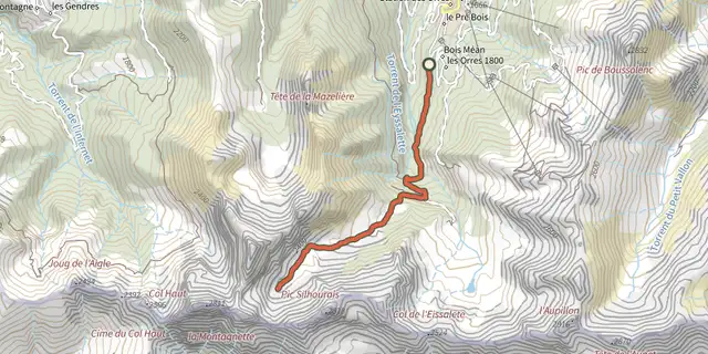
 Plan IGN © IGN 2026Vallon de MuretierProvence-Alpes-Côte d'Azur, Les Orres (05) · Out and backOfficial rating by Parc national des Écrins
 Plan IGN © IGN 2026Lake Sainte MargueriteProvence-Alpes-Côte d'Azur, Les Orres (05) · LoopOfficial rating by Parc national des Écrins
 Plan IGN © IGN 2026The Grand PastreProvence-Alpes-Côte d'Azur, Les Orres (05) · LoopOfficial rating by Parc national des Écrins
 Plan IGN © IGN 2026Col des OrresProvence-Alpes-Côte d'Azur, Les Orres (05) · Out and backOfficial rating by Parc national des Écrins
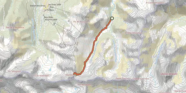 Plan IGN © IGN 2026l'AupillonProvence-Alpes-Côte d'Azur, Les Orres (05) · Out and backOfficial rating by Parc national des Écrins
 Plan IGN © IGN 2026Le MéaleProvence-Alpes-Côte d'Azur, Saint-Sauveur (05) · LoopOfficial rating by Parc national des Écrins