
The Croix du Carrelet crests

Key facts
- Distance
- 8.1 km
- Ascent
- +520 m
- Descent
- −492 m
- Estimated time
- 3 hr
- hiking
- Difficulty
- Moderate
- official rating
- Route
- Loop
- back to the start
Profile and gradient
- under 10%
- 10 to 20%
- over 20%
Gradient along the route: 4.6 km under 10%, 1.4 km at 10 to 20% and 2.0 km over 20%. Elevation from 1,608 m to 2,107 m over 8.1 km.
Surface and path types
- Surface
- Paved 7%
- Dirt & gravel 89%
- Unknown 4%
- Path types
- Trail 76%
- Track 13%
- Road 7%
- Off-network 4%
Description
A fine, easy-going, trilogy circuit combining the quiet of the mountain pastures, the landscape of the crests and the peace of the forest. The magnificent Alpine meadows form a gateway and an invitation to enter the Grand Renaud corrie. In these wild and virgin landscapes, the absolute quiet of the area encourages observation and contemplation. Once you reach the crests, the feeling of isolation gives way to an overwhelming impression of ethereal freedom. The return through the forest immerses the hiker in aromas, a perfect trilogy for recharging your batteries. Park in the entrance car park below Villard-Reymond and take the forest path below the Chemin De Velzut (1614m), which follows the curve of the Cirque du Grand Renaud. After crossing several hollows, the path loops upwards through the magnificent flower meadows in the mountains. The path leads up steeply to Le Grand Riou (1608m), with a plunging view above the wild torrent. From Le Grand Riou, to the left, the winding ascent runs through the vast Grand Renaud corrie, then takes a sharp turn toward a small rocky col up to Le Clot de La Selle (2083m). Continue round the slope through the grass below the crest, until you reach the top. You can then enjoy a panoramic view as far as Croix de Carrelet. The steep, winding descent provides a nice view, then runs through a magnificent forest of larch, pine and spruce. At Col de la Maison du Loup (1785m), turn off towards Villard-Reymond.
Difficulty
Official rating: moderate, by Parc national des Écrins.
Getting there
Start: Villard-Reymond, Villard-Reymond (38).
Sources
- Track: Parc national des Écrins, Licence Ouverte 2.0, Licence Ouverte 2.0 (Etalab) (destination.ecrins-parcnational.fr/trek/937548-Les-cretes-de-la-croix-du-Carrelet). Time estimated by GPX Path with the Mac app rule, breaks not included.
- Surface and path types: © OpenStreetMap contributors, ODbL, extract of 28 October 2026, matched to the track every 10 m (openstreetmap.org/copyright)
- Official elevation gain: 520 m, Parc national des Écrins
Nearby tracks
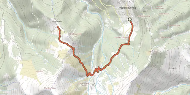
 Plan IGN © IGN 2026Tête de Louis XVI via Col de CorbièreÉcrins, Villard-Reymond (38) · Out and backOfficial rating by Parc national des Écrins
 Plan IGN © IGN 2026The Prégentil headlandÉcrins, Villard-Reymond (38) · Out and backOfficial rating by Parc national des Écrins
 Plan IGN © IGN 2026Le plateau du TailleferÉcrins, Ornon (38) · Out and backOfficial rating by Parc national des Écrins
 Plan IGN © IGN 2026Lauvitel LakeÉcrins, Les Deux Alpes (38) · LoopOfficial rating by Parc national des Écrins
 Plan IGN © IGN 2026Plan Vianney lake and the Périer gapÉcrins, Les Deux Alpes (38) · Out and backOfficial rating by Parc national des Écrins
 Plan IGN © IGN 2026Tour de l'Aiguille de VénoscÉcrins, Les Deux Alpes (38) · Point to pointOfficial rating by Parc national des Écrins