
Tête de Louis XVI via Col de Corbière

Key facts
- Distance
- 8.3 km
- Ascent
- +398 m
- Descent
- −366 m
- Estimated time
- 2 hr 40
- hiking
- Difficulty
- Moderate
- official rating
- Route
- Out and back
- same way back
Profile and gradient
- under 10%
- 10 to 20%
- over 20%
Gradient along the route: 4.6 km under 10%, 2.9 km at 10 to 20% and 0.8 km over 20%. Elevation from 1,608 m to 1,911 m over 8.3 km.
Surface and path types
- Surface
- Paved 3%
- Dirt & gravel 97%
- Path types
- Trail 73%
- Track 24%
- Road 3%
Description
Under the watchful eye of Le Grand Renaud, this royal trail runs over stone ripples and joins up with the Lignarre valley. A varied path blending hollows and flowering meadows, with its highest point being a striking view for all those making the effort to get there. The Tête de Louis XVI via Col de Corbière is a “trophy” that no hikers worth their salt should ignore! Park in the entrance car park below Villard-Reymond and take the forest path below the Chemin De Velzut (1614m), which follows the curve of the Cirque du Grand Renaud. After crossing several hollows, the path begins a winding climb towards the magnificent flowering pastures. The path leads up steeply to Le Grand Riou (1608m), with a plunging view above the wild torrent and its “cauldrons”. From Le Grand Riou, descend slightly to the right to cross the torrent. From there, follow the looping ascent, then cross the hollows up to the meadows as far as Col de Corbières (1926m). Here, you follow the signs to Tête de Louis XVI (1980m), and then go up to the right. You can take the same path back down towards the resort of Col d'Ornon.
Difficulty
Official rating: moderate, by Parc national des Écrins.
Getting there
Start: Villard-Reymond, Villard-Reymond (38).
Sources
- Track: Parc national des Écrins, Licence Ouverte 2.0, Licence Ouverte 2.0 (Etalab) (destination.ecrins-parcnational.fr/trek/937542-La-Tete-de-Louis-XVI-par-le-col-de-Corbiere). Time estimated by GPX Path with the Mac app rule, breaks not included.
- Surface and path types: © OpenStreetMap contributors, ODbL, extract of 28 October 2026, matched to the track every 10 m (openstreetmap.org/copyright)
- Official elevation gain: 398 m, Parc national des Écrins
Nearby tracks
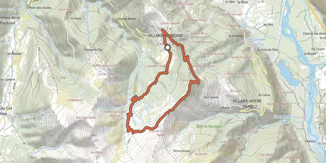
 Plan IGN © IGN 2026The Croix du Carrelet crestsÉcrins, Villard-Reymond (38) · LoopOfficial rating by Parc national des Écrins
 Plan IGN © IGN 2026The Prégentil headlandÉcrins, Villard-Reymond (38) · Out and backOfficial rating by Parc national des Écrins
 Plan IGN © IGN 2026Le plateau du TailleferÉcrins, Ornon (38) · Out and backOfficial rating by Parc national des Écrins
 Plan IGN © IGN 2026Lauvitel LakeÉcrins, Les Deux Alpes (38) · LoopOfficial rating by Parc national des Écrins
 Plan IGN © IGN 2026Plan Vianney lake and the Périer gapÉcrins, Les Deux Alpes (38) · Out and backOfficial rating by Parc national des Écrins
 Plan IGN © IGN 2026Tour de l'Aiguille de VénoscÉcrins, Les Deux Alpes (38) · Point to pointOfficial rating by Parc national des Écrins