
Traces GPX autour du golfe du Morbihan
20 traces GPX autour du golfe du Morbihan, avec distance, dénivelé et durée pour chaque trace. Filtrez par sport, distance, dénivelé et durée.
Régions
Choisissez une région sur la carte ou ci-dessous. En gris : pas encore de traces.
Massifs montagneux
Choisissez un massif sur la carte ou ci-dessous : toutes ses traces, quelle que soit la région.
Toutes les traces GPX autour du golfe du Morbihan
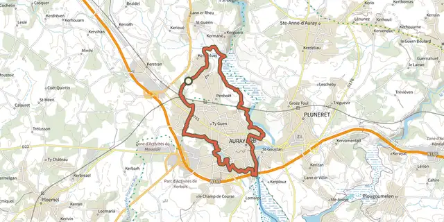
 Plan IGN © IGN 2026 · tracé © OpenStreetMapAutour d’AurayGolfe du Morbihan, Brech (56) · Boucle

 Plan IGN © IGN 2026 · tracé © OpenStreetMapCircuit de KerbilerGolfe du Morbihan, Elven (56) · Boucle
 Plan IGN © IGN 2026 · tracé © OpenStreetMapCircuit de la Chapelle de BéquerelGolfe du Morbihan, Le Bono (56) · Boucle
 Plan IGN © IGN 2026 · tracé © OpenStreetMapCircuit de Moustoir-LorhoGolfe du Morbihan, Theix-Noyalo (56) · Boucle
 Plan IGN © IGN 2026 · tracé © OpenStreetMapCircuit de PencadenicGolfe du Morbihan, Le Tour-du-Parc (56) · Boucle
 Plan IGN © IGN 2026 · tracé © OpenStreetMapCircuit des deux pointesGolfe du Morbihan, Arradon (56) · Boucle
 Plan IGN © IGN 2026 · tracé © OpenStreetMapCircuit des MoulinsGolfe du Morbihan, Saint-Avé (56) · Boucle
 Plan IGN © IGN 2026 · tracé © OpenStreetMapCircuit des Pointes du GolfeGolfe du Morbihan, Arzon (56) · Boucle
 Plan IGN © IGN 2026 · tracé © OpenStreetMapCircuit des TempliersGolfe du Morbihan, Theix-Noyalo (56) · Boucle
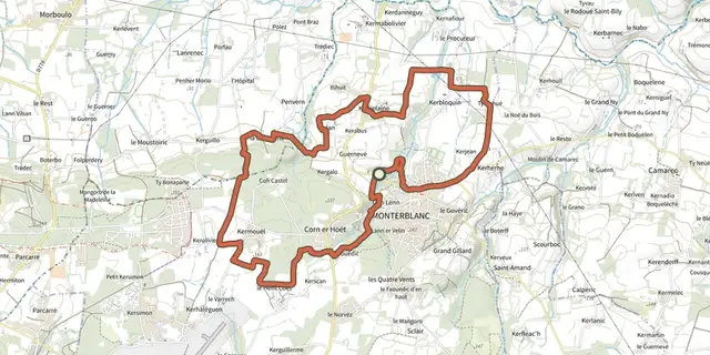 Plan IGN © IGN 2026 · tracé © OpenStreetMapCircuit du GovéroGolfe du Morbihan, Monterblanc (56) · Boucle
 Plan IGN © IGN 2026 · tracé © OpenStreetMapCircuit du Grand MontGolfe du Morbihan, Saint-Gildas-de-Rhuys (56) · Boucle
 Plan IGN © IGN 2026 · tracé © OpenStreetMapCircuit le Petit MontGolfe du Morbihan, Arzon (56) · Boucle
 Plan IGN © IGN 2026 · tracé © OpenStreetMapCircuit le Petit MousseGolfe du Morbihan, Arzon (56) · Boucle
 Plan IGN © IGN 2026 · tracé © OpenStreetMapEntre golfe et océanGolfe du Morbihan, Locmariaquer (56) · Boucle
 Plan IGN © IGN 2026 · tracé © OpenStreetMapLa rivière du BonoGolfe du Morbihan, Le Bono (56) · Boucle
 Plan IGN © IGN 2026 · tracé © OpenStreetMapLa Vallée du CondatGolfe du Morbihan, Saint-Nolff (56) · Boucle
 Plan IGN © IGN 2026 · tracé © OpenStreetMapLes étangsGolfe du Morbihan, Saint-Gildas-de-Rhuys (56) · Boucle
 Plan IGN © IGN 2026 · tracé © OpenStreetMapLes Landes de LamblatGolfe du Morbihan, Surzur (56) · Boucle
 Plan IGN © IGN 2026 · tracé © OpenStreetMapLes parcs ostréicolesGolfe du Morbihan, Sarzeau (56) · Boucle
 Plan IGN © IGN 2026 · tracé © OpenStreetMapVue sur l’océan, Variante par la boucle de PenvinsGolfe du Morbihan, Sarzeau (56) · Boucle