
The sea wall

Key facts
- Distance
- 13.5 km
- Ascent
- +9 m
- Descent
- −0 m
- Estimated time
- 3 hr
- hiking
- Difficulty
- Easy
- official rating
- Route
- Point to point
- ends elsewhere
Profile and gradient
- under 10%
- 10 to 20%
- over 20%
Gradient along the route: 13.5 km under 10%. Elevation from 0 m to 2 m over 13.5 km.
Surface and path types
- Surface
- Paved 9%
- Dirt & gravel 91%
- Path types
- Trail 3%
- Track 89%
- Road 8%
Description
Driven by the sea spray, discover the landscapes of the lower Camargue between the sea and the ponds. A few passages slightly sandy, otherwise the rest of the route is easy... and so beautiful.! The sea wall that isolates the Rhône delta from the influence of the sea reveals amazing wilderness and beautiful lagoons. At the heartof the National Reserve are busy sea birds and birds of brackish environments:: seagulls, terns, gulls, greater flamingos, ducks, herons, waders... From the parking lot of la Gacholle, go along the sea wall towards the lighthouse, following the marked trails. Stay along the sea wall and the indicated paths (Camargue National Reserve). 1- At the Pertuis de Rousty, continue along the sea wall for 6km and reach to the village of Saintes-Maries-de-la-Mer. Alternative route: proceed to the crossing in the other direction, from Saintes-Maries-de-la-Mer.
Difficulty
Official rating: easy, by Parcs naturels régionaux de Provence-Alpes-Côte d'Azur.
Before you go
- A dirt road on 2/3 of its length, the track is impassable in rainy weather. Taking this route at windy times is not advised.
- No water points nor snacking services,: remember to take drinks and food. It’s possible to buy water and the necessary supplies for puncture repairs at the lighthouse of Gacholle (weekends and school holidays from 11.00 to 17.00).
- Accessing the dunes is strictly prohibited, even on foot. Access to the sea is through the marked paths.
Getting there
Start: Parking de la Gacholle, au sud d'Arles, Saintes-Maries-de-la-Mer (13).
Sources
- Track: Parcs naturels régionaux de Provence-Alpes-Côte d'Azur (Chemins des Parcs), Licence Ouverte 2.0, Licence Ouverte 2.0 (Etalab) (www.cheminsdesparcs.fr/trek/14036-SAINTES-MARIES-DE-LA-MER---La-Digue-a-la-Mer). Time estimated by GPX Path with the Mac app rule, breaks not included.
- Surface and path types: © OpenStreetMap contributors, ODbL, extract of 28 October 2026, matched to the track every 10 m (openstreetmap.org/copyright)
- Official elevation gain: 9 m, Parcs naturels régionaux de Provence-Alpes-Côte d'Azur
Nearby tracks

 Plan IGN © IGN 2026Loop between the two arms of the RhoneProvence-Alpes-Côte d'Azur, Saintes-Maries-de-la-Mer (13) · Point to pointOfficial rating by Parcs naturels régionaux de Provence-Alpes-Côte d'Azur
 Plan IGN © IGN 2026Walk in the heart of the Verdier marshesProvence-Alpes-Côte d'Azur, Arles (13) · LoopOfficial rating by Parcs naturels régionaux de Provence-Alpes-Côte d'Azur
 Plan IGN © IGN 2026Salin-de-Giraud, "our history in the Camargue"Provence-Alpes-Côte d'Azur, Arles (13) · LoopOfficial rating by Parcs naturels régionaux de Provence-Alpes-Côte d'Azur
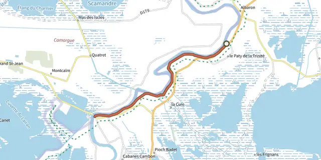 Plan IGN © IGN 2026The Petit-Rhône dikeProvence-Alpes-Côte d'Azur, Arles (13) · Out and backOfficial rating by Parcs naturels régionaux de Provence-Alpes-Côte d'Azur
 Plan IGN © IGN 2026Between rice fields and reed beds on the Pont de Rousty trailProvence-Alpes-Côte d'Azur, Arles (13) · LoopOfficial rating by Parcs naturels régionaux de Provence-Alpes-Côte d'Azur
 Plan IGN © IGN 2026They du Mazet, the Rhône estuaryProvence-Alpes-Côte d'Azur, Port-Saint-Louis-du-Rhône (13) · Out and backOfficial rating by Parcs naturels régionaux de Provence-Alpes-Côte d'Azur