
The balconies of Chorges
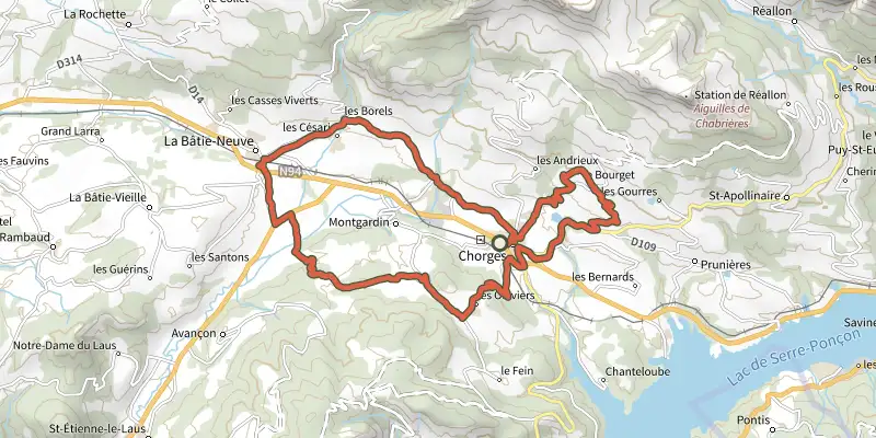
Key facts
- Distance
- 32.2 km
- Ascent
- +854 m
- Descent
- −807 m
- Estimated time
- 2 hr 30
- road cycling
- Difficulty
- Easy
- official rating
- Route
- Loop
- back to the start
Profile and gradient
- under 10%
- 10 to 20%
- over 20%
Gradient along the route: 30.7 km under 10% and 1.5 km at 10 to 20%. Elevation from 777 m to 1,199 m over 32.2 km.
Surface and path types
- Surface
- Paved 100%
- Path types
- Road 100%
Description
Chorges as you've never seen it before! A complete tour to discover every aspect of this village. This route takes in both sides of the Avance valley. From the plains to the mountain passes, you'll be travelling on small roads through a wide variety of landscapes. To finish off this itinerary, a final loop with a fine ascent will give you a magnificent panoramic view of Lake Serre-Ponçon. - From Chorges, take the D614 and ascend towards the hamlet of Les Carles. Continue straight ahead until you come to a crossroads, then turn left onto the "Route des Borels". Descend to the village of La Bâtie-Neuve, skirt the police station and follow the "Route du Laus". Carefully cross the railway line, then the N94, and continue on the D11. - At the junction with the D942, turn left towards Briançon for 500 m then turn right towards Fontclaire. - This little road rises quickly and the view becomes more and more impressive over the Avance plain. The landscape narrows as you approach the mountain. Head past the hamlet of Les Massots and its agricultural plains while staying on the main road. Continue over a small plateau, with a clear view of the terrain. At the next crossroads, turn left and continue towards the village of Les Olliviers. - Continue the route down a gentle slope then cross a railway line and continue to the junction with the D3. Then pass under the N94 towards Réallon. - Now an ascent begins, taking the D9 and still heading towards Réallon. Carry on for 2 km until you spot the directional signs at a Recycling Point. Then take a left fork and climb up to the hamlet of Le Bourget, taking in the views over the valley. - Take the ensuing descent very carefully, to avoid getting carried away by the speed. This will take you to the centre of Chorges and back to the starting point.
Difficulty
Official rating: easy, by Parc national des Écrins.
Getting there
Start: Parking de la gare, Chorges, Chorges (05).
Sources
- Track: Parc national des Écrins, Licence Ouverte 2.0, Licence Ouverte 2.0 (Etalab) (destination.ecrins-parcnational.fr/trek/996006-Les-balcons-de-Chorges). Time estimated by GPX Path with the Mac app rule, breaks not included.
- Surface and path types: © OpenStreetMap contributors, ODbL, extract of 28 October 2026, matched to the track every 10 m (openstreetmap.org/copyright)
- Official elevation gain: 854 m, Parc national des Écrins
Nearby tracks

 Plan IGN © IGN 2026Tour of Mont ColombisProvence-Alpes-Côte d'Azur, Chorges (05) · LoopOfficial rating by Parc national des Écrins
 Plan IGN © IGN 2026Le Col LebrautProvence-Alpes-Côte d'Azur, Chorges (05) · LoopOfficial rating by Parc national des Écrins
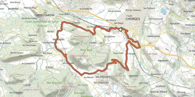 Plan IGN © IGN 2026Discovering Les OlliviersProvence-Alpes-Côte d'Azur, Chorges (05) · LoopOfficial rating by Parc national des Écrins
 Plan IGN © IGN 2026Montée de Réallon depuis ChorgesÉcrins, Chorges (05) · Point to pointOfficial rating by Parc national des Écrins
 Plan IGN © IGN 2026At the gateway to the EcrinsÉcrins, Savines-le-Lac (05) · LoopOfficial rating by Parc national des Écrins
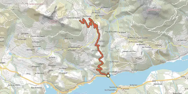 Plan IGN © IGN 2026Montée de Réallon depuis Savines-le-LacÉcrins, Savines-le-Lac (05) · Point to pointOfficial rating by Parc national des Écrins