
Cheiron top
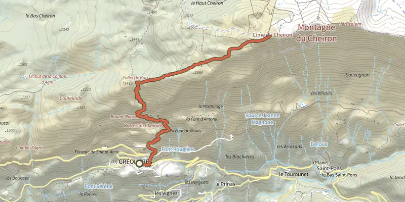
Key facts
- Distance
- 11.3 km
- Ascent
- +926 m
- Descent
- −920 m
- Estimated time
- 5 hr 15
- hiking
- Difficulty
- Difficult
- official rating
- Route
- Out and back
- same way back
Profile and gradient
- under 10%
- 10 to 20%
- over 20%
Gradient along the route: 1.1 km under 10%, 8.8 km at 10 to 20% and 1.4 km over 20%. Elevation from 844 m to 1,768 m over 11.3 km.
Surface and path types
- Surface
- Paved 4%
- Dirt & gravel 96%
- Path types
- Trail 96%
- Track 1%
- Road 3%
Description
20 km of bird’s flight separate the summit (1,778 m) from the Mediterranean. This exceptional situation offers a sumptuous panorama! This limestone mountain with jagged ridges divides the basins of the Esteron and the Wolf. Its imposing south face rises in the background from the Gorges du Loup. Its north face shelters the ski resort of Geôlières-les-Neiges: the most Maritime of the Alps! From the Faisse car park, take the D2 road to reach the marker 30 marking the start of the trail. 1- Take the GR®4 to an intersection marked by the marker 193. 2- Turn left, cross the bars of Cheiron and reach the beacon 194. 3- Engage full east in this open landscape and follow the crests of Cheiron. When the ski lifts appear, the peak of Cheiron will not be very far. 4- The return is made by the same itinerary.
Difficulty
Official rating: difficult, by Parcs naturels régionaux de Provence-Alpes-Côte d'Azur.
Before you go
- After point 3, the open landscape does not allow regular mark-up. Be attentive to your progression. Beware of grazing areas, if you encounter a protection dog, behave appropriately.
Getting there
Start: Parking de la Faïsse, Gréolières, Gréolières (06).
Sources
- Track: Parcs naturels régionaux de Provence-Alpes-Côte d'Azur (Chemins des Parcs), Licence Ouverte 2.0, Licence Ouverte 2.0 (Etalab) (www.cheminsdesparcs.fr/trek/59270-GREOLIERES---Cime-du-Cheiron). Time estimated by GPX Path with the Mac app rule, breaks not included.
- Surface and path types: © OpenStreetMap contributors, ODbL, extract of 28 October 2026, matched to the track every 10 m (openstreetmap.org/copyright)
- Official elevation gain: 926 m, Parcs naturels régionaux de Provence-Alpes-Côte d'Azur
Nearby tracks
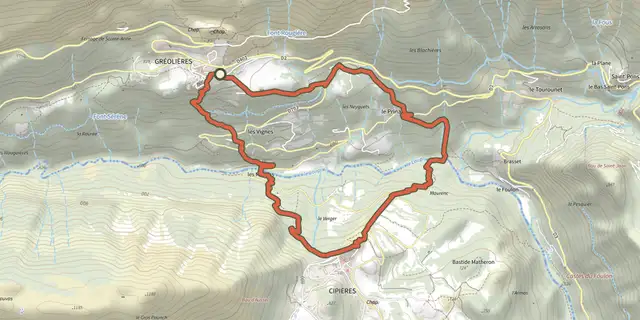
 Plan IGN © IGN 2026Gréolières - Circuit du LoupProvence-Alpes-Côte d'Azur, Gréolières (06) · LoopOfficial rating by Parcs naturels régionaux de Provence-Alpes-Côte d'Azur
 Plan IGN © IGN 2026Cipières - Plateau de CalernProvence-Alpes-Côte d'Azur, Cipières (06) · LoopOfficial rating by Parcs naturels régionaux de Provence-Alpes-Côte d'Azur
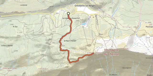 Plan IGN © IGN 2026Gréolières-les-Neiges - Cime du CheironProvence-Alpes-Côte d'Azur, Gréolières (06) · Out and backOfficial rating by Parcs naturels régionaux de Provence-Alpes-Côte d'Azur
 Plan IGN © IGN 2026 · track © OpenStreetMapPlateau de Saint-BarnabéProvence-Alpes-Côte d'Azur, Courmes (06) · Loop
 Plan IGN © IGN 2026Courmes - Pic de CourmettesProvence-Alpes-Côte d'Azur, Courmes (06) · Out and backOfficial rating by Parcs naturels régionaux de Provence-Alpes-Côte d'Azur
 Plan IGN © IGN 2026Coursegoules - Sentier sonoreProvence-Alpes-Côte d'Azur, Coursegoules (06) · Out and backOfficial rating by Parcs naturels régionaux de Provence-Alpes-Côte d'Azur