
17 km - Montauger
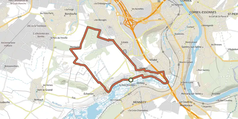
Key facts
- Distance
- 17.2 km
- Ascent
- +110 m
- Descent
- −64 m
- Estimated time
- 50 min
- road cycling
- Difficulty
- Not rated
- Route
- Loop
- back to the start
Profile and gradient
- under 10%
- 10 to 20%
- over 20%
Gradient along the route: 17.2 km under 10%. Elevation from 44 m to 89 m over 17.2 km.
Surface and path types
- Surface
- Paved 41%
- Dirt & gravel 53%
- Unknown 6%
- Path types
- Trail 38%
- Track 37%
- Road 25%
Description
Difficulty
No official rating for this track: we do not make one up.
Getting there
Start: Domaine départemental de Montauger, Lisses (91).
Sources
- Track: Grand Paris Sud, Licence Ouverte 2.0, Licence Ouverte 2.0 (Etalab) (data.grandparissud.fr/explore/dataset/gps-balades-en-velo/). Time estimated by GPX Path with the Mac app rule, breaks not included.
- Surface and path types: © OpenStreetMap contributors, ODbL, extract of 28 October 2026, matched to the track every 10 m (openstreetmap.org/copyright)
- Official elevation gain: 110 m, Grand Paris Sud
Nearby tracks

 Plan IGN © IGN 2026De Corbeil-Essonnes à la forêt de RougeauÎle-de-France, Corbeil-Essonnes (91) · Loop
 Plan IGN © IGN 2026Évry-Courcouronnes, Bondoufle et LissesÎle-de-France, Évry-Courcouronnes (91) · Loop
 Plan IGN © IGN 2026Evry-CourcouronnesÎle-de-France, Ris-Orangis (91) · Loop
 Plan IGN © IGN 20266 km - St-EutropeÎle-de-France, Fleury-Mérogis (91) · Loop
 Plan IGN © IGN 2026La biodiversité est reine aux lacs de l'EssonneÎle-de-France, Grigny (91) · Loop
 Plan IGN © IGN 2026Berges de Seine de Ris-Orangis à Evry et Soisy-sur-SeineÎle-de-France, Ris-Orangis (91) · Loop