
The Château de Fressac

Key facts
- Distance
- 3.9 km
- Ascent
- +185 m
- Descent
- −163 m
- Estimated time
- 1 hr 15
- hiking
- Difficulty
- Moderate
- official rating
- Route
- Loop
- back to the start
Profile and gradient
- under 10%
- 10 to 20%
- over 20%
Gradient along the route: 2.6 km under 10%, 1.0 km at 10 to 20% and 0.3 km over 20%. Elevation from 177 m to 342 m over 3.9 km.
Surface and path types
- Surface
- Paved 55%
- Dirt & gravel 42%
- Unknown 3%
- Path types
- Trail 35%
- Track 9%
- Road 56%
Description
A walk exploring the Château de Fressac and the lower Cévennes. Starting in Montèzes, the path climbs into the holm oak grove to the Château. To the west, panoramic views open up onto the lower Cévennes with the famous Jumelles de Monoblet hills in the foreground. The descent, steep in places, joins up with the path in the plain between vineyards and meadows dotted with orchids. Signposts will guide you all along this route. In the description below, the signposted place names and/or directions are given in bold italics between quotation marks : From the car park, “Chemin de Gourgasses”, walk to “Château de Fressac 1,3 km” via “Les Montèzes” : - Go uphill into the village and continue to “Château de Fressac 1,2 km” via “Les Mattetes”, - At “Les Mattetes”, continue to “Château de Fressac 0,8 km”. After visiting the Château and its surroundings, go downhill to “Sous le château de Fressac”. - At “Sous le château de Fressac”, go right towards “Chemin de Fressac”, - Continue on the road to “Chemin de la plaine”, - At “Chemin de la Plaine”, return to “Les Montèzes, 1,3 km” on the road.
Difficulty
Official rating: moderate, by Parc national des Cévennes.
Before you go
- NB : Parking spaces are limited. Make sure your equipment is appropriate for the day’s weather conditions. Remember that the weather changes quickly in the mountains. Take enough water, wear sturdy shoes and put on a hat.
Getting there
Start: Les Montèzes, Monoblet (30).
Sources
- Track: Parc national des Cévennes, Licence Ouverte 1.0, Licence Ouverte 1.0 (Etalab) (destination.cevennes-parcnational.fr/trek/98837-Le-chateau-de-Fressac). Time estimated by GPX Path with the Mac app rule, breaks not included.
- Surface and path types: © OpenStreetMap contributors, ODbL, extract of 28 October 2026, matched to the track every 10 m (openstreetmap.org/copyright)
- Official elevation gain: 185 m, Parc national des Cévennes
Nearby tracks
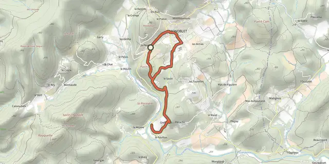
 Plan IGN © IGN 2026Monoblet: the botanical pathCévennes, Monoblet (30) · LoopOfficial rating by Parc national des Cévennes
 Plan IGN © IGN 2026Les jumellesCévennes, Monoblet (30) · LoopOfficial rating by Parc national des Cévennes
 Plan IGN © IGN 2026Le valat de ValestalièreCévennes, Monoblet (30) · LoopOfficial rating by Parc national des Cévennes
 Plan IGN © IGN 2026Cros: the silk trailCévennes, Cros (30) · LoopOfficial rating by Parc national des Cévennes
 Plan IGN © IGN 2026The dolmens of La Grande PallièresCévennes, Anduze (30) · LoopOfficial rating by Parc national des Cévennes
 Plan IGN © IGN 2026From the Camisards to the ResistanceCévennes, Lasalle (30) · LoopOfficial rating by Parc national des Cévennes