
Mont-Vial

Key facts
- Distance
- 9.4 km
- Ascent
- +715 m
- Descent
- −691 m
- Estimated time
- 4 hr
- hiking
- Difficulty
- Difficult
- official rating
- Route
- Out and back
- same way back
Profile and gradient
- under 10%
- 10 to 20%
- over 20%
Gradient along the route: 2.8 km under 10%, 4.2 km at 10 to 20% and 2.4 km over 20%. Elevation from 849 m to 1,543 m over 9.4 km.
Surface and path types
- Surface
- Paved 9%
- Dirt & gravel 91%
- Path types
- Trail 91%
- Road 9%
Description
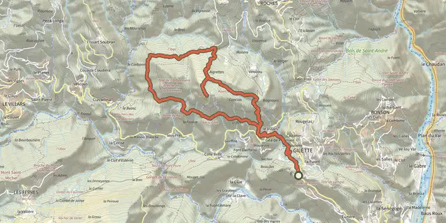
This massive mountain plays the role of sentry of the high valleys and offers the visitor a look of exceptional magnitude. Perched at over 1,550 m above sea level, it is one of the highest peaks in the Préalpes d'Azur Regional Natural Park. Offering a magnificent 360 ° view, Mont-Vial allows you to rub shoulders with the high mountains of the Mercantour National Park, while having an eye on the Mediterranean. Moreover, it belongs to these rare identifiable summits since the Cote d'Azur. The trail starts shortly after the center of the village from Nice. 1- 1- Take a right turn on an asphalt track. Continue on a path passing behind some houses via the beacon 32. The trail rises quietly before winding up a bit. Continue climbing to an intersection 4 km from this point. 2- Turn off to the left as indicated at the beacon 8, then climb to the summit crest of Mont-Vial, which is easily reached via the beacon 285. 3- The return is made by the same itinerary.
Difficulty
Official rating: difficult, by Parcs naturels régionaux de Provence-Alpes-Côte d'Azur.
Before you go
- - Balisage et entretien des chemins par le Département des Alpes Maritimes
Getting there
Start: Revest-Les-Roches, Revest-les-Roches (06).
Sources
- Track: Parcs naturels régionaux de Provence-Alpes-Côte d'Azur (Chemins des Parcs), Licence Ouverte 2.0, Licence Ouverte 2.0 (Etalab) (www.cheminsdesparcs.fr/trek/62474-REVEST-LES-ROCHES---Le-Mont-Vial). Time estimated by GPX Path with the Mac app rule, breaks not included.
- Surface and path types: © OpenStreetMap contributors, ODbL, extract of 28 October 2026, matched to the track every 10 m (openstreetmap.org/copyright)
- Official elevation gain: 715 m, Parcs naturels régionaux de Provence-Alpes-Côte d'Azur
Nearby tracks
 Plan IGN © IGN 2026Gilette - Le tour du Mont LionProvence-Alpes-Côte d'Azur, Gilette (06) · LoopOfficial rating by Parcs naturels régionaux de Provence-Alpes-Côte d'Azur
 Plan IGN © IGN 2026Toudon - Cime des CollettesProvence-Alpes-Côte d'Azur, Toudon (06) · LoopOfficial rating by Parcs naturels régionaux de Provence-Alpes-Côte d'Azur
 Plan IGN © IGN 2026Bouyon - Gorges de l'EsteronProvence-Alpes-Côte d'Azur, Bouyon (06) · LoopOfficial rating by Parcs naturels régionaux de Provence-Alpes-Côte d'Azur
 Plan IGN © IGN 2026Coursegoules - Circuit de ViériouProvence-Alpes-Côte d'Azur, Coursegoules (06) · LoopOfficial rating by Parcs naturels régionaux de Provence-Alpes-Côte d'Azur
 Plan IGN © IGN 2026Coursegoules - Sentier sonoreProvence-Alpes-Côte d'Azur, Coursegoules (06) · Out and backOfficial rating by Parcs naturels régionaux de Provence-Alpes-Côte d'Azur
 Plan IGN © IGN 2026Plan des NovesProvence-Alpes-Côte d'Azur, Vence (06) · LoopOfficial rating by Parcs naturels régionaux de Provence-Alpes-Côte d'Azur