
The Colombier lookout

Key facts
- Distance
- 5.7 km
- Ascent
- +288 m
- Descent
- −274 m
- Estimated time
- 50 min
- trail running
- Difficulty
- Easy
- official rating
- Route
- Loop
- back to the start
Profile and gradient
- under 10%
- 10 to 20%
- over 20%
Gradient along the route: 3.1 km under 10%, 2.1 km at 10 to 20% and 0.4 km over 20%. Elevation from 1,157 m to 1,426 m over 5.7 km.
Surface and path types
- Surface
- Paved 23%
- Dirt & gravel 77%
- Path types
- Trail 70%
- Track 7%
- Road 23%
Description
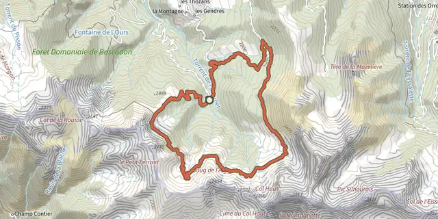
This forest trail winds its way through Boscodon forest, culminating in the Colombier lookout, which offers panoramic views over the Durance valley and the peaks of the Ecrins National Park. Starting from the famous Boscodon abbey, the trails wind through this impressive, unspoilt mountain forest. The streams and springs along the way are refreshing, making the climb to the Colombier lookout a pleasant one. - From Boscodon Abbey, head up the road towards the Grand Clos car park. At the crossroads, turn right over the bridge. At the end of the bend, take the path opposite which drops back onto the track. - Leave it by crossing the torrent on the left, then continue opposite on the wide track. Stay on it until you descend once more to the stream. The path initially climbs up the right bank and then into the forest via a number of hairpins. Further up the path becomes a track that joins the road. - Descend the road for 50 m to the Colombier lookout. At the bend, leave the road and take a path down into the forest. At the intersection, continue to the right until you reach the road again. Cross it and continue straight ahead on the balcony path. - At the crossroads, continue straight ahead on the path. Stay on the road for 50m and take a right path onto the footpath. At the crossroads, keep right until you reach a chalet. Pass it and stay on the road as you descend to the start.
Difficulty
Official rating: easy, by Parc national des Écrins.
Getting there
Start: Abbaye du Boscodon, Crots, Crots (05).
Sources
- Track: Parc national des Écrins, Licence Ouverte 2.0, Licence Ouverte 2.0 (Etalab) (destination.ecrins-parcnational.fr/trek/995599-Le-belvedere-du-Colombier). Time estimated by GPX Path with the Mac app rule, breaks not included.
- Surface and path types: © OpenStreetMap contributors, ODbL, extract of 28 October 2026, matched to the track every 10 m (openstreetmap.org/copyright)
- Official elevation gain: 288 m, Parc national des Écrins
Nearby tracks

 Plan IGN © IGN 2026Morgon loopÉcrins, Crots (05) · LoopOfficial rating by Parc national des Écrins
 Plan IGN © IGN 2026Ring roadÉcrins, Crots (05) · LoopOfficial rating by Parc national des Écrins
 Plan IGN © IGN 2026Pierre-ArnouxÉcrins, Savines-le-Lac (05) · LoopOfficial rating by Parc national des Écrins
 Plan IGN © IGN 2026Around the lakeÉcrins, Embrun (05) · LoopOfficial rating by Parc national des Écrins
 Plan IGN © IGN 2026Mont GuillaumeÉcrins, Embrun (05) · LoopOfficial rating by Parc national des Écrins
 Plan IGN © IGN 2026Pré closÉcrins, Embrun (05) · LoopOfficial rating by Parc national des Écrins