
Circuit du Manéguen

Key facts
- Distance
- 4.2 km
- Ascent
- +122 m
- Descent
- −123 m
- Estimated time
- 1 hr 10
- hiking
- Difficulty
- Not rated
- Route
- Loop
- back to the start
Profile and gradient
- under 10%
- 10 to 20%
- over 20%
Gradient along the route: 3.5 km under 10%, 0.4 km at 10 to 20% and 0.2 km over 20%. Elevation from 44 m to 155 m over 4.2 km.
Difficulty
No official rating for this track: we do not make one up.
Getting there
Start: Guénin, Guénin (56).
Sources
- Track: © OpenStreetMap contributors, ODbL 1.0 (www.openstreetmap.org/relation/21390874). Time estimated by GPX Path with the Mac app rule, breaks not included.
Nearby tracks

 Plan IGN © IGN 2026 · track © OpenStreetMapCircuit du GoyerdonBrittany, La Chapelle-Neuve (56) · Loop
 Plan IGN © IGN 2026Quistinic - Circuit du BourgBrittany, Quistinic (56) · Loop
 Plan IGN © IGN 2026Quistinic - Circuit de Poul FetanBrittany, Quistinic (56) · Point to point
 Plan IGN © IGN 2026 · track © OpenStreetMapLes Bons VoisinsBrittany, Landévant (56) · Loop
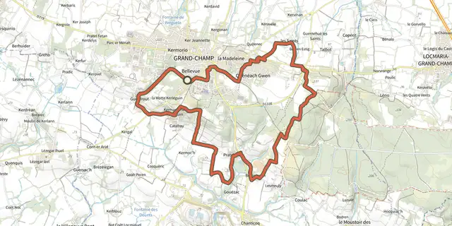 Plan IGN © IGN 2026 · track © OpenStreetMapCircuit Tro GregamBrittany, Grand-Champ (56) · Loop
 Plan IGN © IGN 2026 · track © OpenStreetMapLannouanBrittany, Landévant (56) · Loop